|
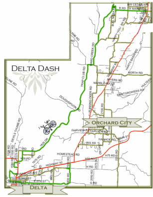
Delta Dash – Distance of 24 ½ miles local road and 11 miles of State Highway for a total of almost 35 miles. The Dash is a graceful start heading west out of town and eventually intersecting Slaughter Grade, (for the experienced rider with good brakes). At the bottom of the grade the road meanders through the south swale of Coalby Canyon with the dobies protruding through the green fields. The remaining route into Delta consists of rolling hills lowering the cyclist into the Gunnison Valley adjacent to Confluence Lake. The dash back to Cedaredge extends east through Delta and up onto Garnet Mesa, with the remaining route primarily along State Highways with adequate right of way.
|
|
|
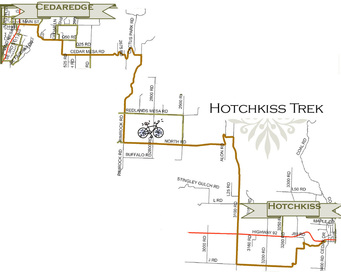
Hotchkiss Trek – Distance 22 local road miles. The trek to Hotchkiss can be one way or double your miles by return trip. It is suggested that the cyclist avoid Highway 92 as a return option. This trek is for an experienced rider. Long climbs and long downhill courses should be expected.
|
|
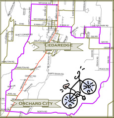
Fruit Loop – Distance 19 local road miles and 1 State Highway for a total of 20 miles. The agrarian route is a glimpse into the orchard industry past and orchardist practice of today. With every difficult hill climb comes a wistful descent into fruit and wine country.
|
|
|
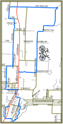
Cedaredge Coaster – Distance of 14 miles local road and 1 ½ miles State Highway for a total of 15 ½ miles. The coaster winds around town and jets uphill on Surface Creek road above 7000 feet in elevation. At the eastern portion of Ute Trail Road heading west the bicyclist will marvel at the inspiring landscape below while coasting cautiously through the highway intersection and turning south on 2300 Road. Only a short detour from this route is Aspen Trails a wonderful pit-stop for ice cream and nourishment. Continuing south along 2325 Road are magnificent fields below as the cyclist returns to town.
|
|
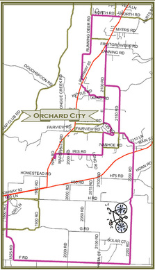
Orchard City Lap – Distance 23 local road miles and 3
State Highway miles for a total of 26 miles. Start your lap in Eckert, a post office village within Orchard City municipal boundaries. This designated route is fitted for a novice rider with stamina. Although the route infuses a hill climb or two, the route is made up of fairly mild transitions. Other paved roads in the area can be easily substituted within the route for more or less difficulty.
|
| ||